
These are the awesome posters from the 2021 NC GIS Conference. A big congratulations to the winners of the voting.
- Todd Hayes – City of Greensboro: Traffic Accidents – City of Greensboro
- Ray Aull – City of Raleigh: Prioritizing Areas for Planning
- John Vogler – NCSU: World Map of Music 1st Edition: Distribution of Songs about Cities
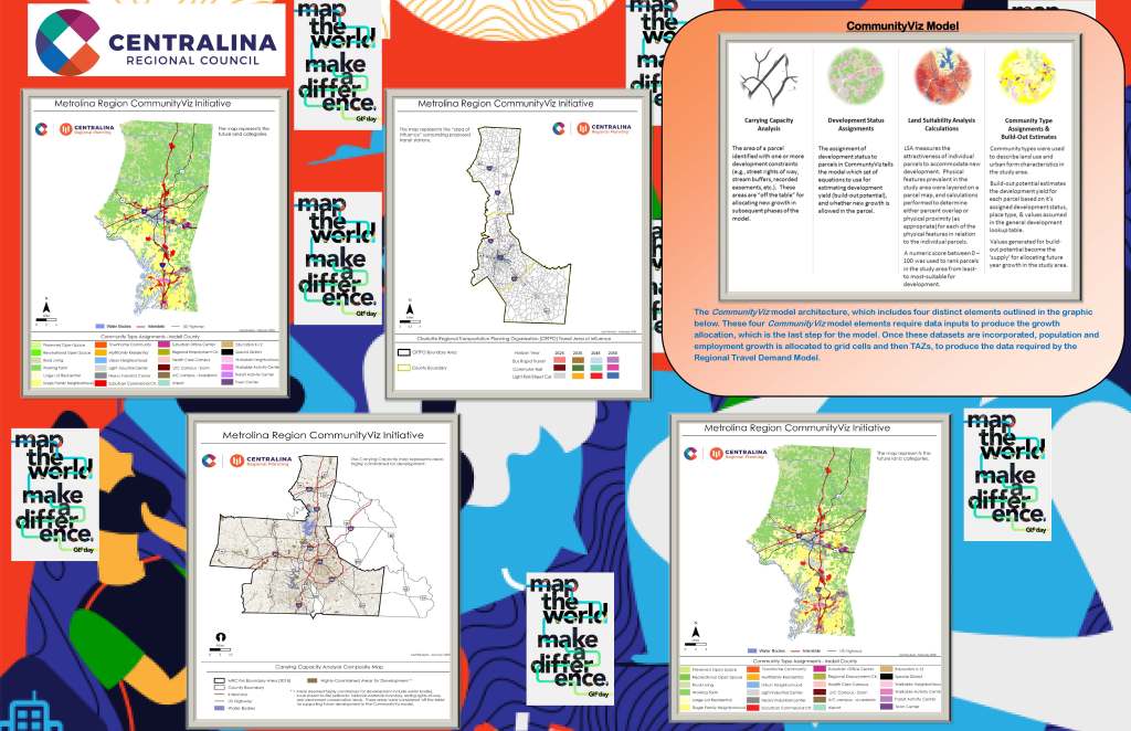
CommunityViz Model Architecture – Aarti Sharma – Centralina Regional Council 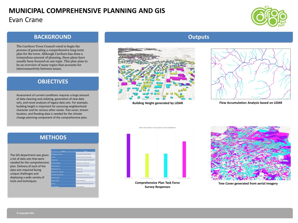
Municipal Comprehensive Planning and GIS – Evan Crane – Town of Carrboro 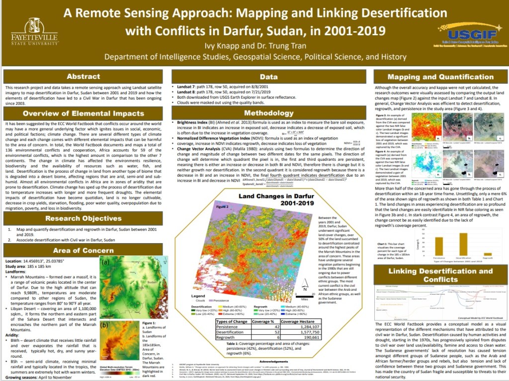
A Remote Sensing Approach: Mapping and Linking Desertification with Conflicts in Darfur, Sudan, in 2001-2019 – Ivy Knap – Fayetteville State University 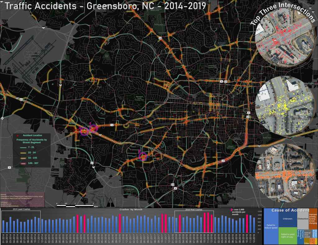
1st Place Traffic Accidents – City of Greensboro – Todd Hayes – City of Greensboro 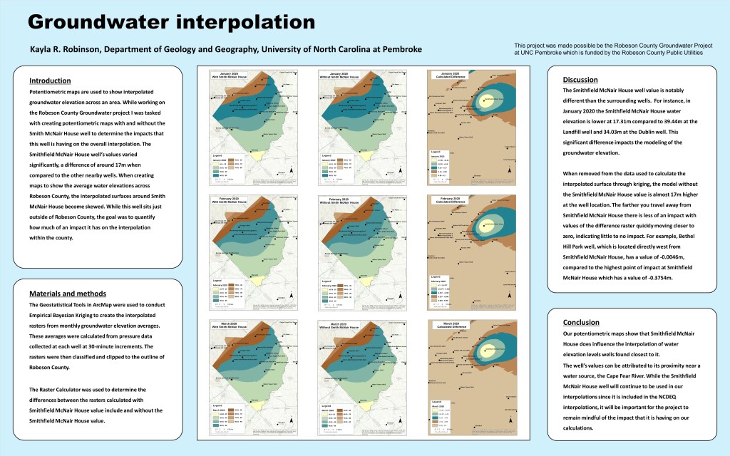
Groundwater Interpolation – Kayla Robinson – UNC Pembroke 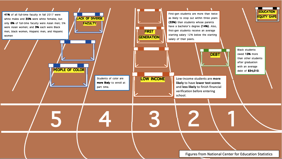
Hurdles to Education – Uchenna Osia – CGA 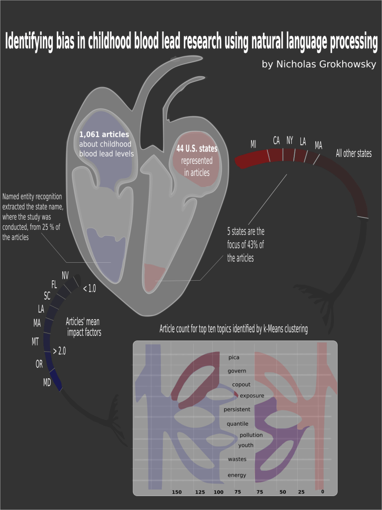
Identifying bias in childhood lead research using natural language processing – Nicholas Grokhowsky – NCSU 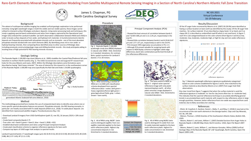
Rare-Earth Elements Minerals Placer Deposition Modeling From Satellite Multispectral Remote Sensing Imaging in a Section of North Carolina’s Northern Atlantic Fall Zone Transition – Jim Chapman – NC Geological Survey 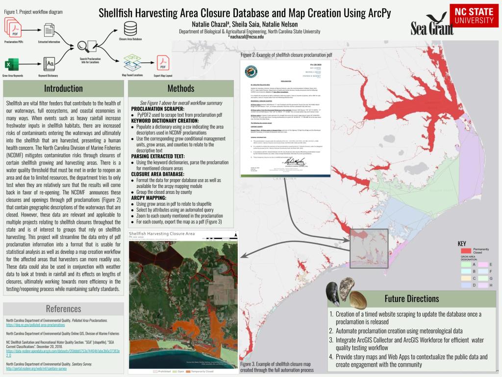
Shellfish Harvesting Area Closure Database and Map Creation Using ArcPy – Natalie Chazal – NCSU 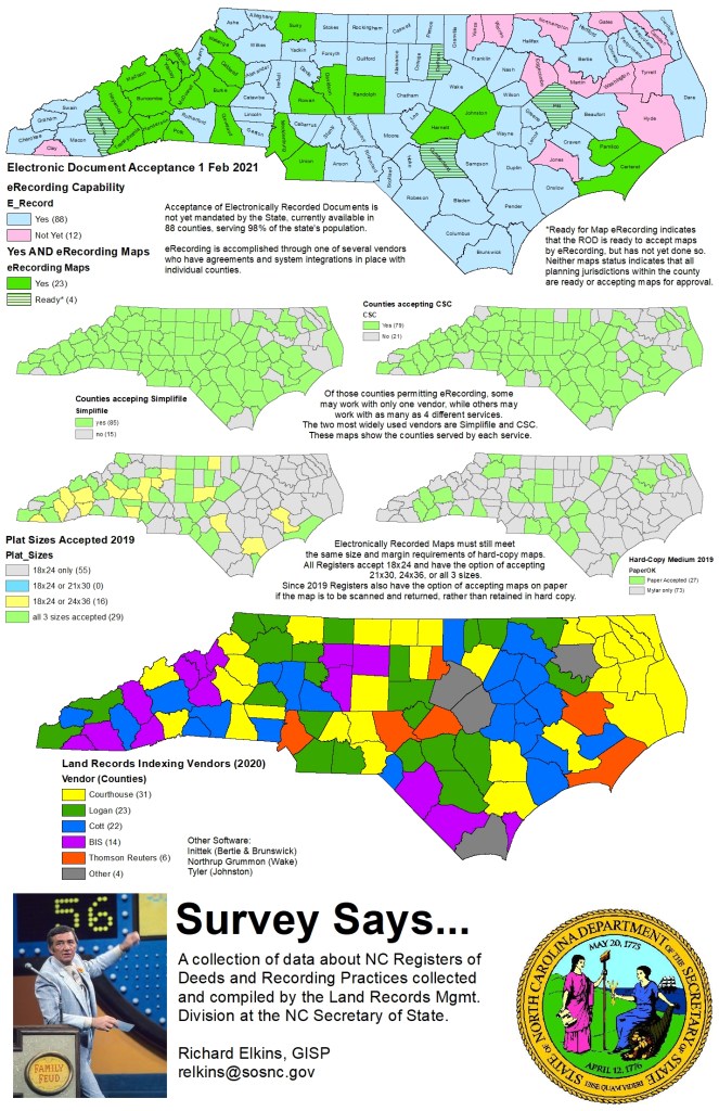
Survey Says: Collected Data on NC Registers of Deeds and eRecording – Richard Elkins – NCSOS 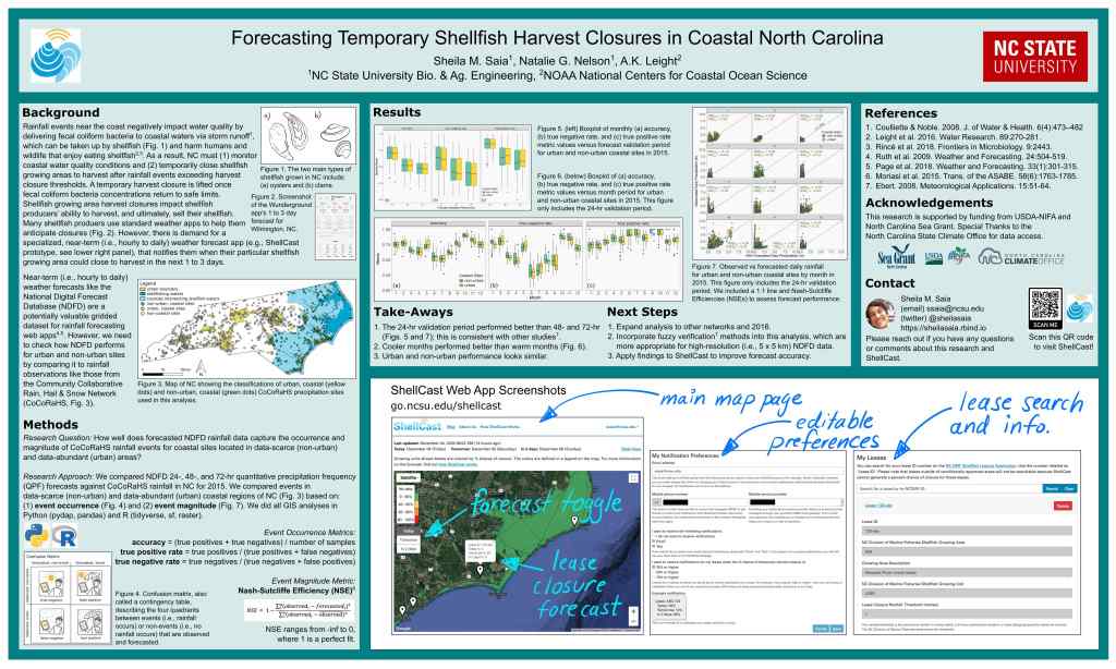
Forecasting Temporary Shellfish Harvest Closures in Coastal North Carolina – Sheila M. Saia – NCSU 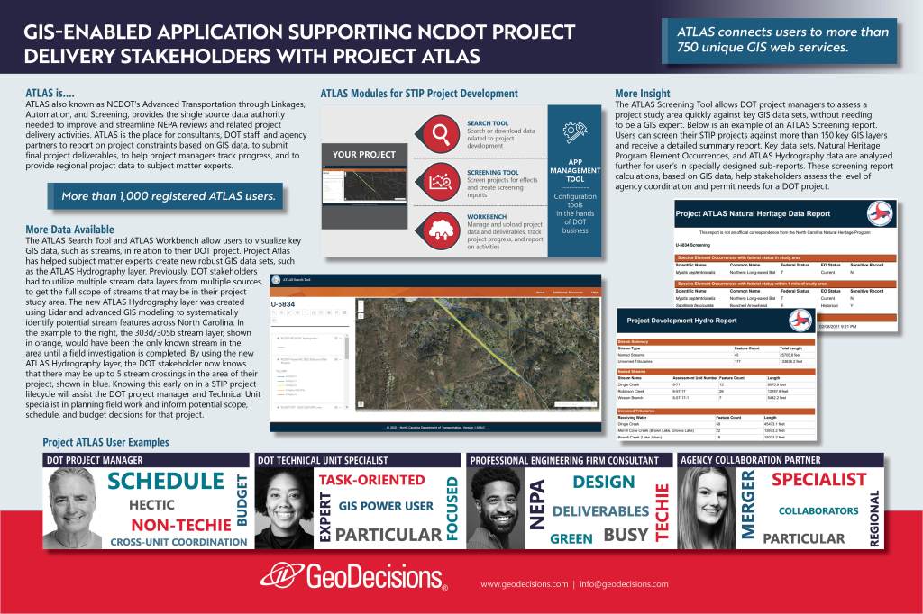
GIS Enabled Application Supporting NCDOT Project Delivery Stakeholders with Project Atlas – Ms. Caitlen Meyer 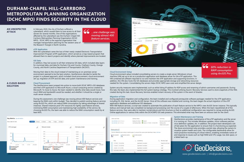
Durham-Chapel Hill-Carrboro Metropolitan Planning Organization (DCHC MPO) Finds Security in the Cloud – Sean Burke – GeoDecisions 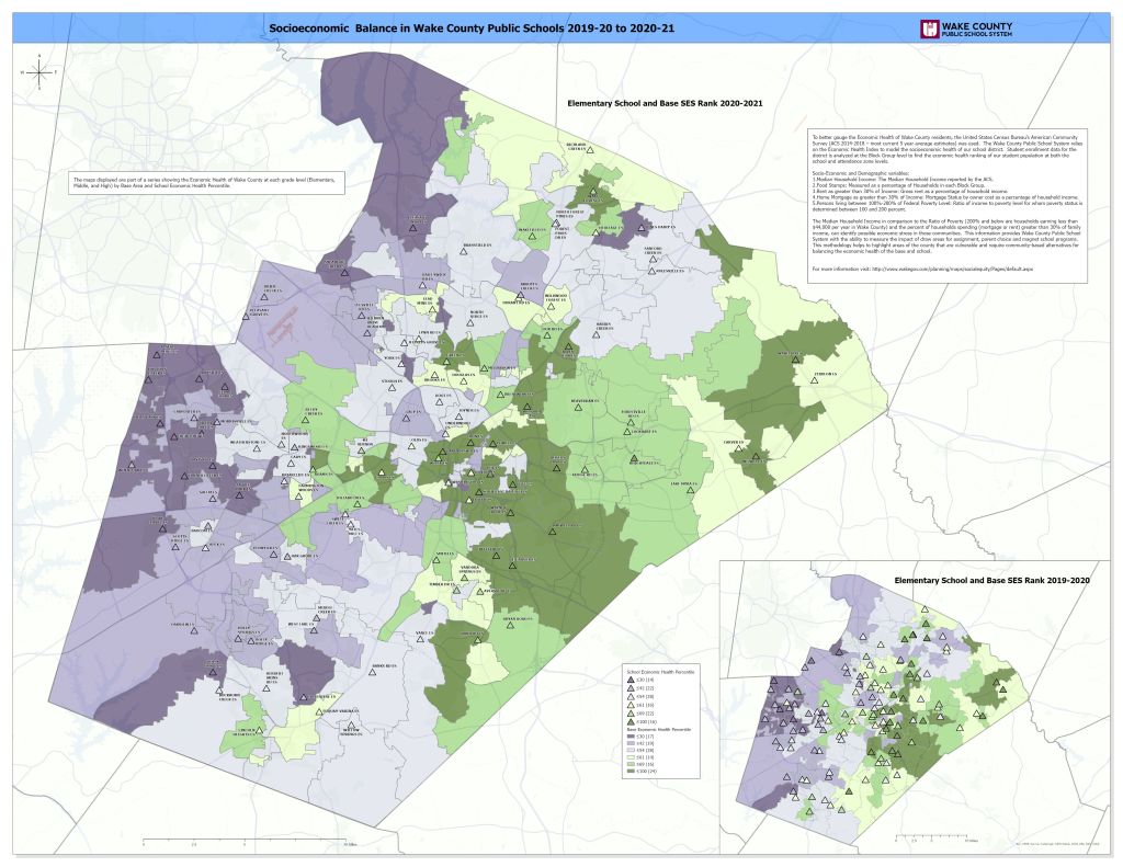
Socioeconomic Balance in Wake County Public Schools 2019 to 2020 – Daniel Hoff – WCPSS 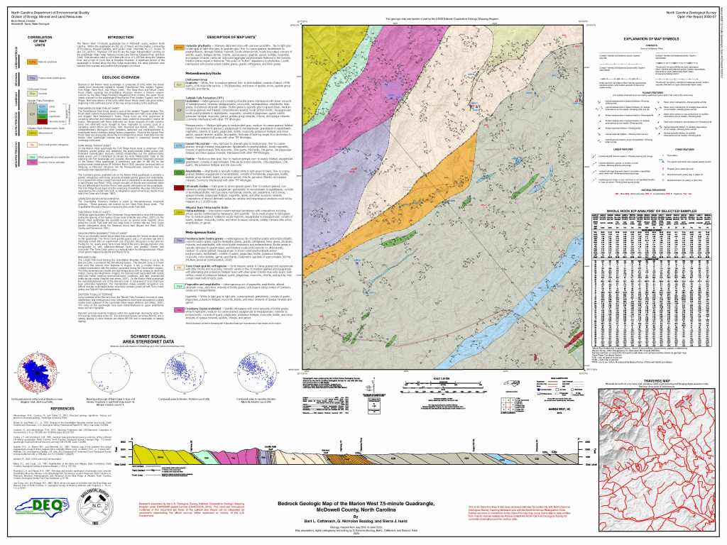
Bedrock Geologic Map of the Marion West 7.5-minute Quadrangle, McDowell County, North Carolina – Nick Bozdog – NC Geological Survey 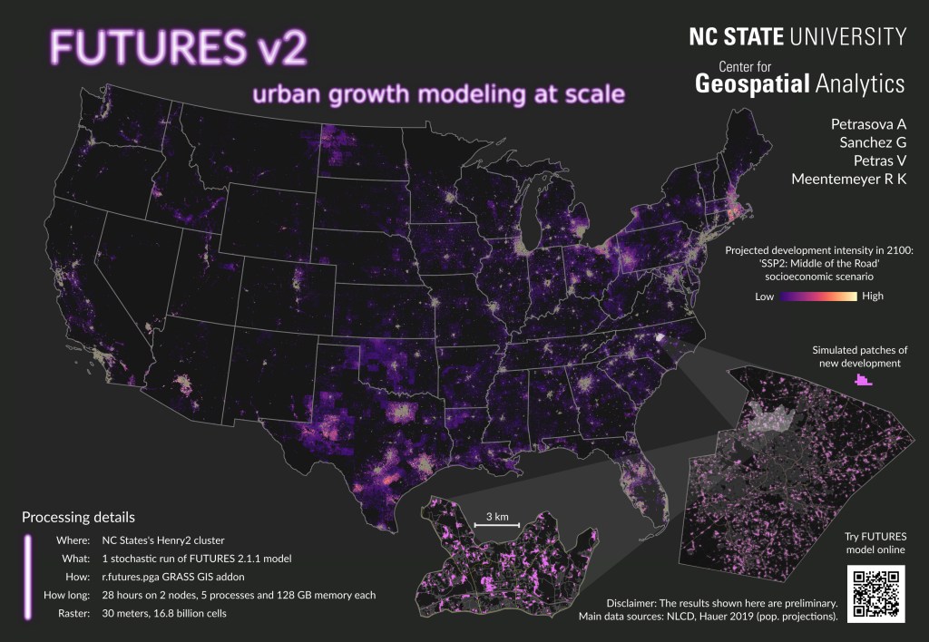
FUTURES v2: Urban Growth Modeling at Scale – Anna Petrasova – NCSU 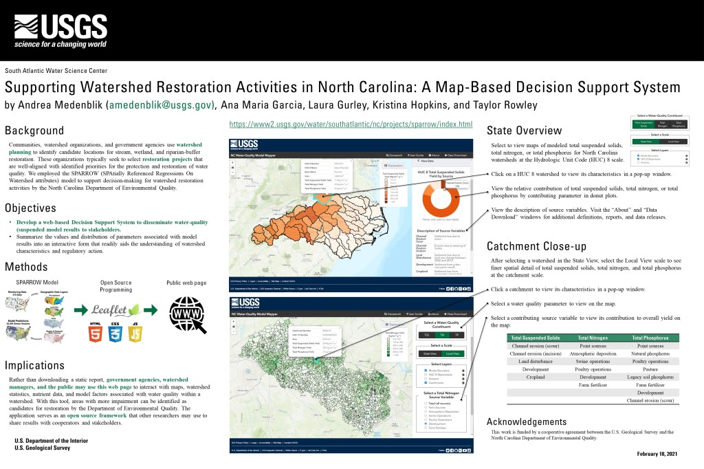
Supporting Watershed Restoration Activities in North Carolina: A Map-Based Decision Support System – Andrea S. Medenblik – USGS 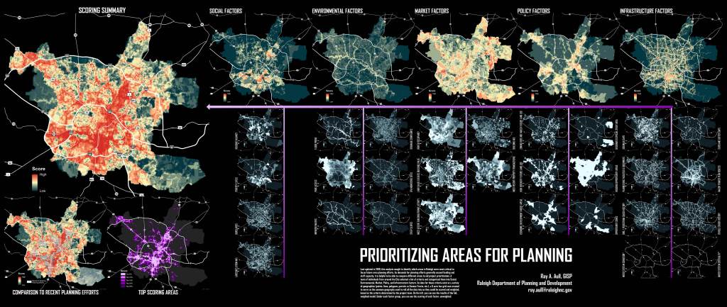
2nd Place: Prioritizing Areas for Planning – Ray Aull – City of Raleigh Planning and Development 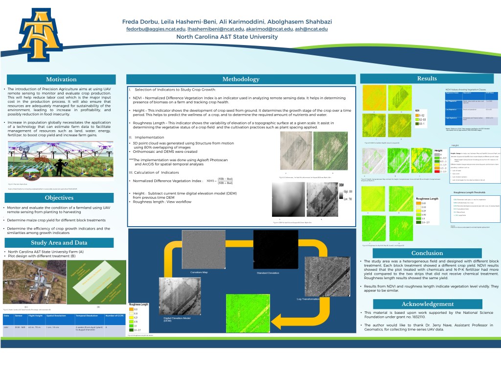
Time-Series Crop Growth Study using UAV Remote Sensing – Freda Dorbu – NC A&T 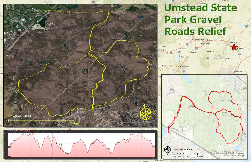
Umstead State Park Gravel Roads Relief – Andrew Futrell – NCSU 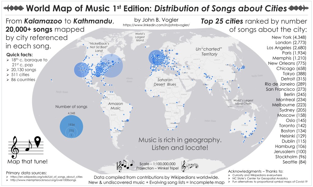
3rd Place: World Map of Music 1st Edition: Distribution of Songs about Cities – John B. Volger – NCSU 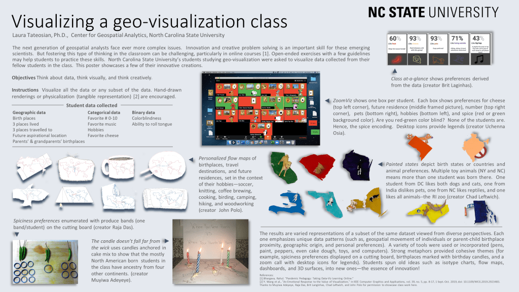
Visualizing a Geovisualization Class – Dr. Laura Tateosian – NCSU

You must be logged in to post a comment.